
Point Cloud Management
Point cloud import (e.g. laser scanner data). Coloured display in the base map, in longitudinal profiles and cross-sections. Create and output drawings to any common plotters or printers.
Point Cloud Evaluation
Generate longitudinal profiles, cross-sections and terrain points from point clouds. Additional commands in the cross-section designer to access point cloud data in cross-sections.
3D Project View
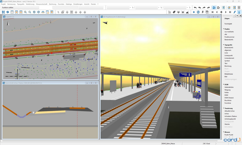
The 3D Project View enables you to analyse your project data in 3D and helps you to locate possible glitches or errors in your design at a very early stage.
The software has been highly optimized in order to process even large quantities of data quickly and conveniently. E.g. complex digital terrain models and point clouds which as a 3D image can display any detail from any angle, thus ideally complementing the information on the existing conditions.
This module supports the BIM planning process.
Image Documentation
Photo and video documentation for projects. Importing and managing geo-referenced images. Automatic transformation and positioning of images containing coordinates. Display and editing of images in the base map.
Route Simulation
Animated test-drive of roads and railway tracks plus fly-overs in the 3D project model. To test project data visually or for presentations. Visualize the sight distances according to RAL, HViSt and others.
This Module supports the BIM-planing process.
Sight Distances

With one mouse click, you can determine the required as well as the actual stopping and overtaking sight distances; for both directions of travel and according to the relevant guidelines. You can calculate the actual sight distances by choosing either a vertical alignment-related 2D method or a complex 3D method which takes the three dimensional geometry of the road into account.
The information on the determined sight distances is displayed in a very clear manner in the graphics and can be integrated into longitudinal profile drawings, cross-section drawings and into base maps. The required sight distances can easily be determined using the card_1 route simulation.
This module supports the BIM planning process more >
card_1 makes it easy to check that your designs are in line with the Visualisation Guidelines HViSt for standard spatial elements, concealed starts of curves and critical areas of obstructed vision.
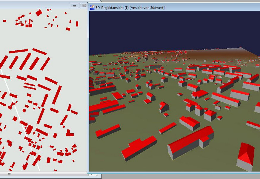
Modelling Existing Conditions
Generating 3D objects of the existing conditions incl. user defined or code based attribute assignment.
3D Symbol Catalogue for Road and Traffic

All traffic signs of the German Traffic Regulations in photo-realistic 3D images as card_1 Catalogue/Rules Framework. Traffic Lights, Danger Signs, General Traffic Signs, Road Furniture, Traffic Regulations Signs, Additional Signs. Selection of design models as a 3D-Model such as people or groups of people and vehicles for free. Visualizing in the 3D Project View, Route Simulation and Virtual Reality modules.
Rail Structures

Generation of 3D objects for rail structures. BIM-compliant attribution.
Virtual Reality
Displaying 3D project data in virtual space. Move freely within the 3D project. Simulate routes and assess sight distances in virtual space. Detect conflicts/glitches more easily. Real simulaton. Clear presentations and visualisation.
Bridge Generator
Generate bridges as structures as part of the route development. BIM-standard structure of the assemblies. Use for drawings, sight distance calculation, structure catalog and BIM export. Standard bridge schematics included.
CityGML Import
Import 3D-building data (3D-city models). Visualize in card_1 in e.g. the 3D-project view. Transformation into project coordinates-system 'on the fly'(requires the Transformation module).
IFC Import/Export
Generating BIM route structures from cross-sections and 3D surfaces from DTMs; Importing/exporting IFC objects to exchange 3D project data incl. engineering structures (spatial structures) and quantity records from REB methods in BIM projects. Model visualization and transfer via VDC Manager Viewer.
OpenStreetMap Import
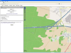
Import data in the OpenStreetMap-format as card_1 topographic data.
LandXML Import/Export
Import and export terrain models, alignments, vertical alignments and cross-sections in the LandXML format.
CPIXML Import/Export
Generates BIM-route structures from cross-sections and 3D surfaces from DTMs; import/export project data incl. structures (volumes) and quantity positions from REB-methods in the CPIXML format (data exchange RIB iTWO, ceapoint DESITE etc.). Model visualization and exchange via card_1 DESITE share.
OKSTRA Export Design
Export card_1 data (schematics: 008 – design, 018 – geometry, 021 – general. Geometry objects incl. point clouds, 022 – land acquisition (requires Land Acquisiton Logging module), 024 – Cadastre, 030 – topography) in the OKSTRA format.
OKSTRA Import Design
Import data (schematics: 008 – design, 018 – geometry, 021 – general. Geometry objects incl. point clouds, 030 – topography) in the OKSTRA format.