Drawing Editing
card_1 drawings have a very clear structure and provide various protection features to guarantee against unwanted operations. The intelligent drawing structure enables you to replace layers and objects very easily.
The data access is very quick, the editing features extremely convenient and the display quality is outstanding. The high data accuracy guarantees seamless data export into other formats.
Drawing Editing
You can create, edit and compile scale-related or project-related drawings with this module. The drawings can be output to any common plotters or printers.
Clear drawing structures, convenient editing functions and a sound management system aid you when creating drawings. The structure and architecture of the drawings as well as the various features to re-use drawing components helps you to avoid doubling up on work and to quickly create follow-up drawings.
The multi-user feature is ideal for planning teams. Within one project a project group can work on the different components of a drawing simultaneously.
Drawing Editing is required to manage and output drawings which you previously generated with the drawing generators in the areas base map, alignment, vertical alignment, cross-section, rail and sewer.
Hybrid Drawing Editing
You can jointly output raster data and vector data into one drawing with this module, i.e. you can mix raster data and vector data in one drawing.
This is a very easy way to upgrade your drawings by simply adding your clients’ logo or trademarks. Or you can incorporate photos for project documentation purposes or overview maps.
Alignment Drawing / Alignment Drawing (Rail)

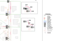
You can create complete and technically sound alignment drawings with flexible annotations, carriageway edges and gradient changes. The batch mode enables you to generate multiple drawings in one step.
Alignment drawings may be displayed as a background layer in all base maporiented applications.
Profile Drawing / Profile Drawing (Rail)
You can create engineering-grade longitudinal profile drawings with vertical alignments, longitudinal ground profiles, flexible annotations, curvature strings, cant gradient strings, sight distance strings or other strings.
These drawing components can be displayed together with tangent strings, dimensionings, drawing sheet borders and title block fields in a card_1 drawing.
Profile Drawing (Sewer)
You can create complete, technically-sound profile drawings in compliance with the existing guidelines with flexible annotations, sewers and other strings.
Sewer profile drawings may also be generated in reference to any existing road longitudinal profile. These drawing portions are displayed in the same manner with tangent strings, dimensions, drawing sheet borders and titleblocks in one drawing.
Sewer Base Map Drawing

You can create complete, ready-to-deliver, technically-sound sewer base map drawings in compliance with the existing guidelines with flexible annotations. This module is especially useful when logging the existing conditions, for reconstruction works or when planning sewer networks as well as when planning road drainage systems.
Sewer base maps may be combined with any other technical drawings and displayed in the base map view.
Cross-Section Drawing / Cross-Section Drawing (Rail)

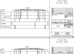
You can create cross-section drawings with individual sheet positioning, flexible annotation and design.
You can display and output surveying vehicles, road and rail furniture objects, trees and hedges. more >
