Our Story So Far
IB&T is an internationally oriented company active in the field of CAD software development. For over 40 years now our product, card_1, has been prized by our customers as a powerful, one-stop system.
1985
Mr Harry Basedow (BEng) is both the proprietor and Managing Director of IB&T Software GmbH, having created the software system card_1 in 1985. Right from the start card_1 stood out with its road planning modules and powerful cross-section designer. Since then, card_1 has been continually expanded and perfected.
1988
Harry Basedow (BEng) and Thomas Tornow (BBA) founded the company Ingenieurbüro Basedow & Tornow GmbH on 1 November 1988.
1989 - 1993
In 1989 IB&T presented the first graphic vertical alignment designer, closely followed by the introduction of the graphic-interactive alignment designer – a revolutionary new development on the German market.
The new rail modules and ground-breaking graphic-interactive switch calculation were first launched at the CeBIT trade fair in 1992, allowing IB&T to maintain its position as market leader in rail planning software. In 2000, the card_1 network adjustment was certified by Deutsche Bahn AG (German Federal Railways). This enabled all engineering offices to use card_1 for precise evaluation of track geometry surveying for the German Federal Railways.
A further two areas of application were introduced in 1993, when the newly-developed sewer modules and hybrid data processing were integrated into card_1.
1994 - 1999
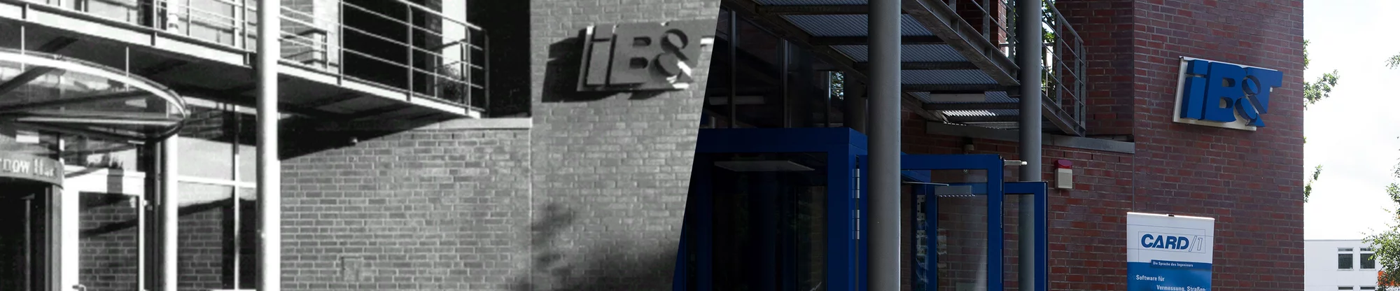
In order to satisfy the needs of the growing market, IB&T relocated to its own office building in Norderstedt, near Hamburg, in 1995. This was the ideal location from which to co-ordinate all activities in the German market. Head Office's attractive architecture clearly reflected the importance placed on transparency and openness. The same could be said for IB&T's relationships to customers, partners and staff.
IB&T established its presence in China in 1994, providing the local planning institutes with a flexible, adaptable tool with which large-scale projects in particular could be handled in their entirety using the card_1 Chinese version. The next step came in 1998, when a local IB&T office was set up in Xi'an. Then came quite a coup: a Chinese planning institute chose to plan the world's first commercial Maglev route using the card_1 Chinese version, thus setting a significant milestone in IB&T's history.
2000 - 2001
In 2001 the local Chinese office was turned into a wholly-owned subsidiary, now known as Xi'an card_1 Software Co., Ltd.
IB&T gained additional specialist knowledge when it took over GEO DIGITAL GmbH of Düsseldorf in the year 2000. Since 1983 GEO DIGITAL had produced individual comprehensive solutions for geodesy and planning track-bound transport systems. Their new kinematic surveying and evaluation system GEOPAC-Kiss, jointly developed by GEO DIGITAL and the University of the German Armed Forces in Munich, opened up new synergies in surveying, data logging and data processing.
In 2001 IB&T introduced card_1 eView, an innovative new product designed to present, document, archive and distribute planning projects. This meant the documents of any one planning project were all combined into a single homogenous, digital information platform, available to any observer in a digital form. Experience showed that paperless digital planning folders were the future of information management.
2002 - 2004
IB&T released numerous modules which made project work with card_1 even easier and more efficient. Calculating sight distances, presenting planning results in 3D using driving simulations or redesigning existing roads using the road surface optimisation module were such examples, as were reconstructing surveyed roads/rail routes using the automatic alignment module or using the graphic fieldbook designed especially for surveying in the field.
As early as 2002, IB&T was one of the first software providers to offer interface modules for OKSTRA-compliant data exchange. The German state road building authorities then introduced OKSTRA as a comprehensive new standard for data exchange.
In 2004 IB&T developed 3D data mapping of traffic routes, allowing users to log road and rail route data economically with their unique, powerful technology. This allowed for no-contact logging of traffic routes while driving at speeds of up to 100km/h.
Road and rail alignments, carriageway lanes and carriageway lane edges, vertical alignments, cross-sections, surface models, clearance spaces and information on traffic route condition could then be derived from this digital data using card_1.
2005 - 2007
The next addition to the IB&T group was RZI Software GmbH, which joined in 2005. Based in Nuremberg, RZI was extremely successful in the areas of CAD and GIS, and had developed modular comprehensive solutions covering every area of civil engineering. Their CAD application card_1 for AutoCAD was an excellent addition to card_1 as it could handle any civil engineering or infrastructure-related task.
With the release of Version 8.0, IB&T launched a new generation of software onto the market – innovative, with a modern, easy-to-use user interface, MDI technology, object-oriented project work and dynamic data updates. This was software purpose-designed for the unique tasks demanded of civil engineering.
2007- 2011
card_1 generation 8 saw continual development in each area, taking particular note of customer wishes. Thanks to improved user friendliness and sophisticated solutions, project work subsequently become easier and more reliable. Results could be presented more clearly and impressively.
Generating 3D structures became possible. In each project view/plan view, in interface views and the 3D view, structures were displayed and represented in their actual dimensions. This was useful for both design and visualisation. 3D structures, complete with their actual geometry, could then be generated from project data literally at the touch of a button.
The dynamic driving test, aimed at testing track alignments, was first presented. The Rail module was particularly well equipped to scan existing routes at high speed. Critical areas could thus be quickly identified. The dynamic driving test of track alignments became an absolute must for all newcomers - even old hands appreciated the benefits of this new tool.
2012
IB&T presented the new design system for Road Design at the INTERGEO trade fair in Hanover, giving customers and business partners their first look at the new system designed to deliver top quality planning results. An intelligent data model made seamless support and automation possible, from the first draft right through to drawing and data export. IB&T was definitely on the right path to make card_1 an ever more technically intelligent system.
The then current version of card_1, Version 8.4, focused on the following features: point cloud processing functions, image documentation, the graphic field book, extended swept turning path calculation, 3D sewer network calculation and the new rail planning functions such as flexible processing of railway structures, clearance structures and platform edges. card_1 ran equally well under Windows 8.
2013 - 2015
A new strategic cooperation with aRES Datensysteme expanded the product range. card_1 could then offer expert solutions for sewer planning, sewer calculation, damage reporting, evaluation of existing conditions, sewer rehabilitation, pipe design, pipe calculation and pipe network management. The aRES infrastructure and management modules were an ideal extension of card_1’s comprehensive civil engineering software solution.
2016 - 2017
The AKVS Cost Calculation program was developed. It supported all cost planning processes from the cost framework to cost estimation and cost calculation according to the AKVS 2014 regulations. Sales partnerships with G&W Software AG and BECHMANN GmbH aimed to win new customers with a joint market presence.
IB&T became a member of the Road and Transportation Research Association (FGSV) and was heavily involved in the FGSV's Working Committee 9.7 "Fundamental Issues in Data Processing".
With the integral and central use of card_1 planning data, spatial representation and 3D simulation, card_1 became a planning system that implemented the essential principles of BIM Building Information Modelling. As a member of BuildingSMART, an association that promotes the standardisation of processes and open interfaces (OpenBIM), IB&T became involved in the standardisation of BIM-compliant data exchange.
At the INTERGEO 2017 in Berlin, IB&T presented a futuristic method of working, initially as part of the introduction of the BIM method, and demonstrated its entry into virtual reality using 3D design models.
2018 - 2019
IB&T now produced traffic route design software on various CAD platforms. Customers and potential buyers could procure a complete software package for surveying, traffic route and infrastructure design. In order to convey the idea of a one-stop solution, the company was renamed IB&T Software GmbH on 9 July 2018.
Four new logos designed around a uniform layout along with a new business look highlighted the bond between IB&T and its subsidiaries, thus projecting The IB&T Group's shared path.
Created by IB&T, the specialist group «BIM Traffic Routes», part of buildingSMART, was formed to deal with issues particular to traffic route design.
IB&T again set the benchmark with its smart infra-modelling technology, as seen at INTERGEO 2019. It was at the heart of the upcoming card_1 Generation 10 and made intelligent, BIM-compliant traffic route modelling possible.
2020 - 2022
In November 2022, card_1 version 10.0 celebrated its release. The New Road Design heralded an innovative working method based on smart infra-modelling technology, giving users a future-proof application for surveying, designing and building traffic routes.
Today
In June 2023, IB&T founder and shareholder Harry Basedow withdrew from day-to-day operations as managing director at his own request, but will continue to contribute his specialist knowledge to the company as a consultant. He is succeeded by Bernard Braun (MA BEng), who now leads the Norderstedt-based software company along with Managing Director Uwe Hüttner and Authorised Signatory Christine Picker.
With over 7,000 users, card_1 is one of the most widely used applications for civil engineering, surveying and planning in both Germany and worldwide.
From the word go, card_1 has also had many devotees beyond Germany, as evidenced by the popularity of the English, Chinese, Polish and Russian versions of card_1. Today IB&T looks back on such international success with pride, and yet knows that it is but the base upon which future challenges will be met.
Satisfaction is guaranteed by the IB&T Group, and those with a service contract can change products should the need arise. As the customer, you have complete say over which products best suit you and your needs.
Our employees work either at our headquarters in Norderstedt, at our various branch offices or from home. They are happy to assist you in any matters relating to the software solutions sold by the IB&T Group.
Partnerships with Thinkproject Deutschland GmbH and Bluebeam GmbH have expanded the product range with efficient solutions for BIM and digital workflows. In addition to the in-person and online training courses already offered, the card_1 e-learning portal was activated in early 2023, allowing users to learn flexibly and at their own pace.