East Africa‘s Gateway to the World
The state-owned port operator Kenya Ports Authority is investing in the future. The port of Mombasa is being further expanded as a central hub in East Africa. Since 2014, Inros Lackner has been supporting the development of the port with general planning services ranging from the creation of a master plan to technical and special planning through to construction supervision. Johannes Augustin
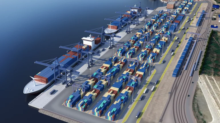
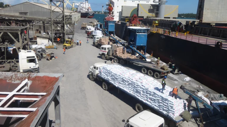
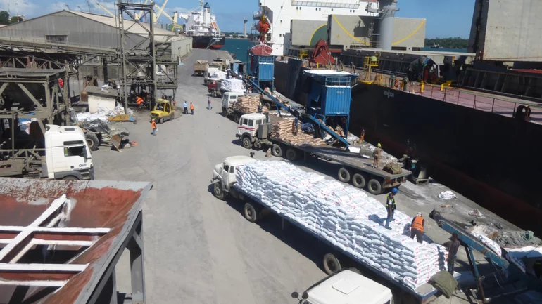
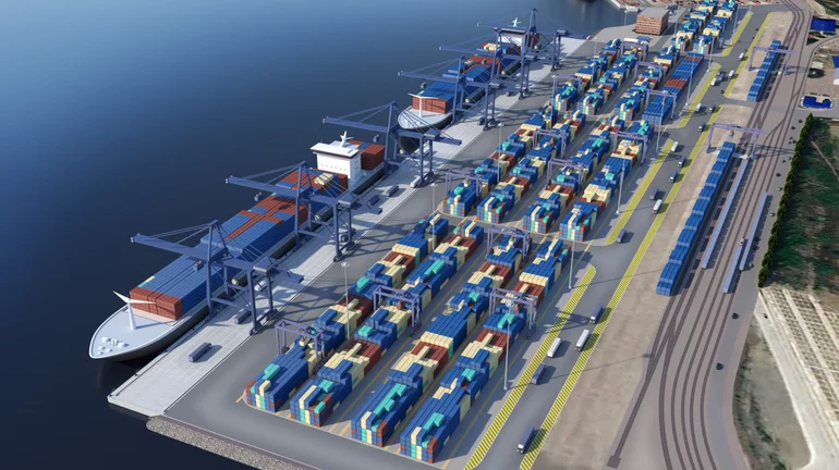
It is the largest deep sea port in the region and an engine for economic development in Kenya and landlocked countries such as Uganda, Burundi and Rwanda. The port has a more than 4km long quay wall and 18 deep-water berths, including 5 berths for container handling. The cargo volume in container shipping is growing sustainably and accounts for about 70 percent of the handling volume. Forecasts call for infrastructure modernisation and the expansion of capacities. In future, ships with a draught of up to about 14.5m should be able to berth in the port of Mombasa. In addition to international maritime traffic, the port is also visited by feeder ships and small dhow or coastal ships. They ensure the supply of nearby coastal regions.
Existing Conditions & Initial Construction Measures
First, the condition of the port facilities had to be logged, examined and evaluated. In the process, the entire port area was resurveyed by means of both aerial photography and bathymetric surveys on the water side of the quays. The data thus obtained formed the basis for a feasibility study that included possible rehabilitation and expansion measures. Port rezoning alternatives were developed alongside plans to renew and expand quay facilities and the landside port areas. This included the roads and railways in the port, the handling equipment and the operational and administrative buildings. In the next step, the feasibility study served to coordinate measures to adapt the individual port areas with the client and to invite tenders for the detailed engineering plans concerning the quay wall and terminal infrastructure. The initial building measures have already been carried out and rehabilitation work on the existing port facilities have been completed.
New Traffic Concept
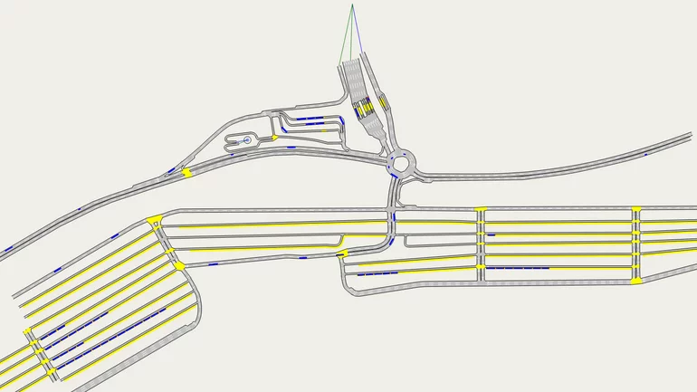
At the end of 2018, Inros Lackner was additionally commissioned to conduct a traffic study for both the port in Mombasa and the Inland Container Depot (ICD) in Nairobi. The ICD Nairobi is directly connected to the port of Mombasa with the new standard gauge railway line. This was the basis for the reorganisation and adaptation of the road and rail links in the port area and for the adjacent hinterland. In order to optimise the traffic flow in the port area, the team developed a concept for the traffic routing using simulation, then supplemented it with a traffic guidance and signage concept.
card_1 in Operation
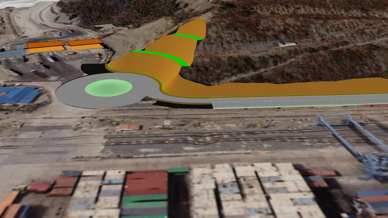
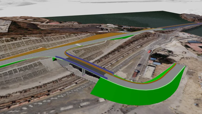
The planning documents for the new traffic concept were all created with the help of card_1 surveying and design software. This included general services, such as quantity calculation, as prep-work for the tender specifications (separated by lots). It also involved the creation of various detailed plans for the tender documents, examples of which are an office building for car park management, a new footpath on the bridge to the head office, road and footpath cross-sections, profiles, retractable bollards, bus shelters, footpaths over existing drainage ditches, roundabouts, signposting and car park numbering. The BIM visualisation of a roundabout with a berm and the adjoining section of the port perimeter road as well as a traffic simulation of this section of development using video were also part of the work spectrum.
Port of Mombasa
The team provided the following services specifically for the port of Mombasa:
- Import of all existing as-built base map plans and plans of any current projects (DWG, PDF).
- Import of LiDAR data (geo-referenced TIFF data and point clouds) from 2014 to create a 3D model of the port area with texture. The newer structures not included in the current 3D data were added following a levelling survey.
- A study for gap closure and width optimisation of the Back of Port (BOP) Road. This is the main connecting road for all port traffic along the landside port boundary, an approx 1.2km section of which does not yet exist. Optimisation of the position and height of the port boundary road at the new bridge to the Kenya Ports Authority headquarters, over a length of approx. 0.8km. Drafting of profiles and cross sections as well as optimisation of the swept turning paths at the on- and off-ramps.
- Definition and classification of parking areas for cars in the port area and at the main entrance, incl. a proposal for a pedestrian bridge.
- Development of a detailed footpath concept for the entire port area, definition of all road crossings by means of zebra crossings.
- Definition of a route for bus traffic with corresponding bus bays at the bus stops.
- Design of information boards at road entrances as visitor info, design of uniform signposting for port buildings.
- Design of a truck parking area outside the port area as a waiting zone with parking spaces for approx. 500 trucks and an office building for the car park manager.
Traffic Guidance System
In addition, a traffic guidance system was designed for the entrances to each terminal:
- Setting up two roundabouts at the main junctions with clearly signposted lanes for each terminal in order to ensure that lanes can be closed in front of the roundabout. This is necessary as access to the terminals always requires crossing the railway tracks in the port. This will ensure that the roundabout is kept open for the remaining through traffic if the access to the terminals has to be closed off due to a train entering or leaving.
- Partial traffic routing in the roundabout by colour coding the way to the different terminals.
- Vertical signposting: guidance, prohibition, mandatory and information signs, directional and destination boards with corresponding individual lettering, also horizontal traffic routing markings.
Inland Container Depot Nairobi
The following services were associated with the ICD:
- Design of truck parking areas as waiting zones outside the container depot with parking space allocation for approx. 2,500 trucks and several office buildings for car park management.
- Design of information boards at road entrances as visitor info, design of uniform signposting for port buildings.
- Development of a walkway concept for the administration area.
Traffic Guidance System
A traffic guidance system was also designed for the entrances to each terminal (direction of travel largely clockwise) and for the newly planned truck parking areas:
- Vertical signposting: guidance, prohibition, mandatory and information signs, directional and destination boards with corresponding individual lettering for area surrounding ICD.
- Horizontal traffic routing markings.
Multidisciplinary & International
A multidisciplinary Inros Lackner team consisting of Kenyan and German employees provided the diverse general planning and consulting services for the development of the port in cooperation with local and international partners: "Further complex construction measures will continue to secure Mombasa's status as a central logistics hub in East Africa in the future," predicts Johannes Augustin, author of this article and International Project Manager at Inros Lackner.
Contractor:
INROS LACKNER SE
Linzer Str. 3
28359 Bremen
Fon +49 421 658410
Fax +49 421 6584110
E-Mail to INROS LACKNER
www.inros-lackner.de
