Mega Project in Ivory Coast
Following years of bitter political crisis, Côte d‘Ivoire is now working to re-establish its political stability and economic pre-eminence in West Africa. Infrastructure in particular is to be upgraded in order to foster neighbouring and international trade. One such measure is to extend the existing A3 highway inland by 132km. The entire new section of road into the centre of the country was designed using card_1.
Within the framework of two national development programmes (National de Développement and Renaissance des Infrastructures en Côte d’Ivoire), Ivory Coast's government resolved to continue development on the A3 highway, which already links the southern economic metropolis of Abidjan with the more northerly capital city Yamoussoukro. The new stretch of road is to go from the capital to Bouaké, the third largest city in the country. It lies in the middle of Ivory Coast and is within reach of Liberia and Guinea to the west, Mali and Burkina Faso to the north and Ghana in the east.
Ambitious Planning
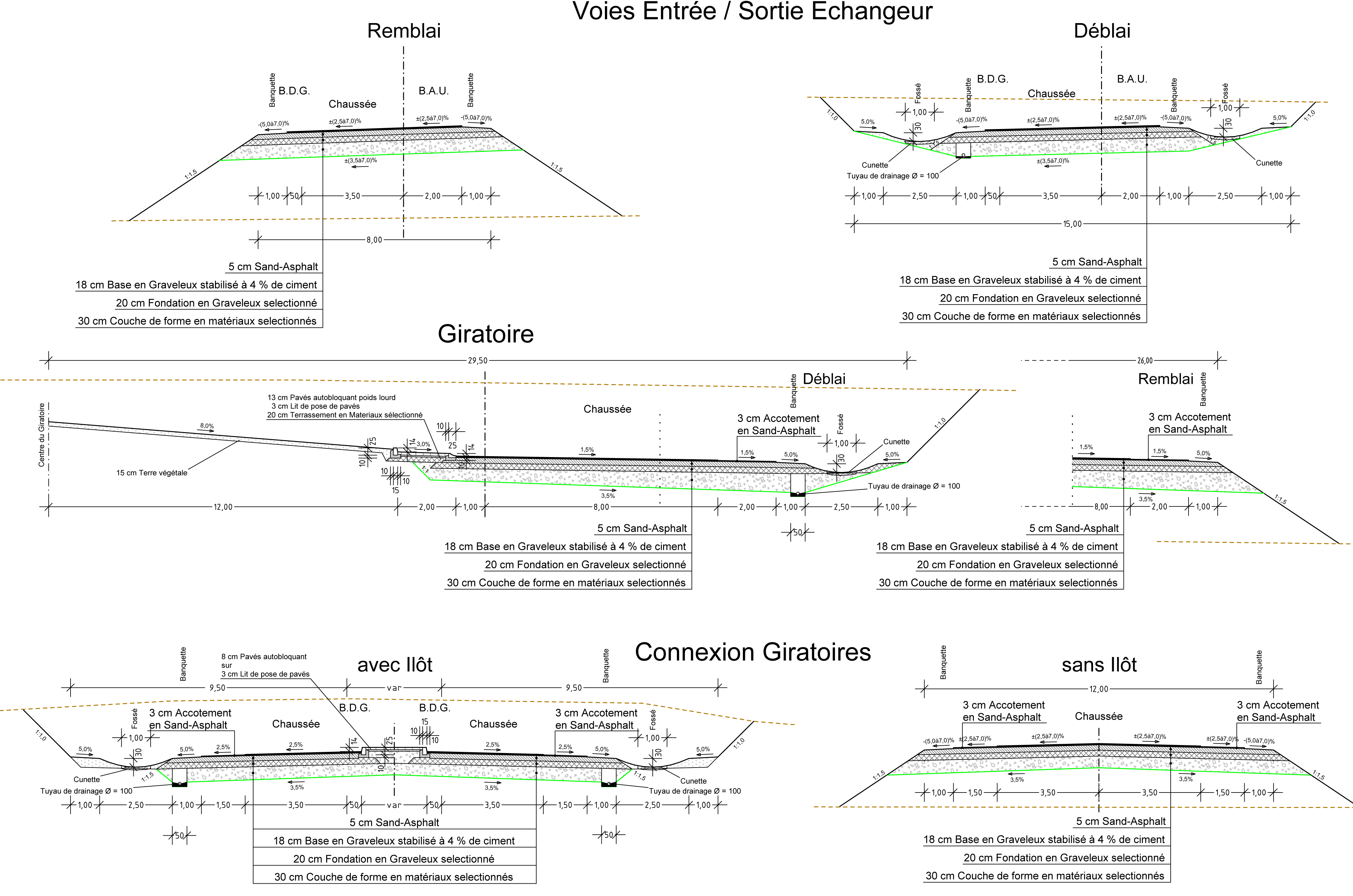
The West African Finance and Currency Union started by hiring H.P. Gauff Ingenieure GmbH & Co KG to conduct a feasibility study. Research to ascertain the best route produced three variations, each complete with full costing including pre-planning and final designs and the corresponding tender documents. In addition to the national highway a further 18.5km of high-speed roadway connecting the highway to the city centres was planned. A two-lane carriageway in each direction was specified (expandable to three lanes) plus a median strip and hard shoulder. The planners had a tight 18 months to complete their designs.

Extensive Project
Once the pre-designs were ready, the project was split into two lots. Lot no.1 contained the first 30km of highway plus 6km of connecting/high-speed roadway while lot no.2 involved the remaining 86km of motorway and 11km of connecting road into Bouaké's city centre. Although the project was initially planned as a single unit, as things progressed the client requested the split as only one financial backer was found to finance 30km of new roadway.
Design Parameters
Planning proceeded according to the regulatory framework laid down by ICTAAL (Instruction sur les conditions techniques d’aménagement des autoroutes de liaison), the technical guidelines for motorway and overland roadway planning, and ICTAVRU (Instruction sur les conditions techniques d’aménagement des voies rapides urbaines), the regulations for heavily frequented urban areas.
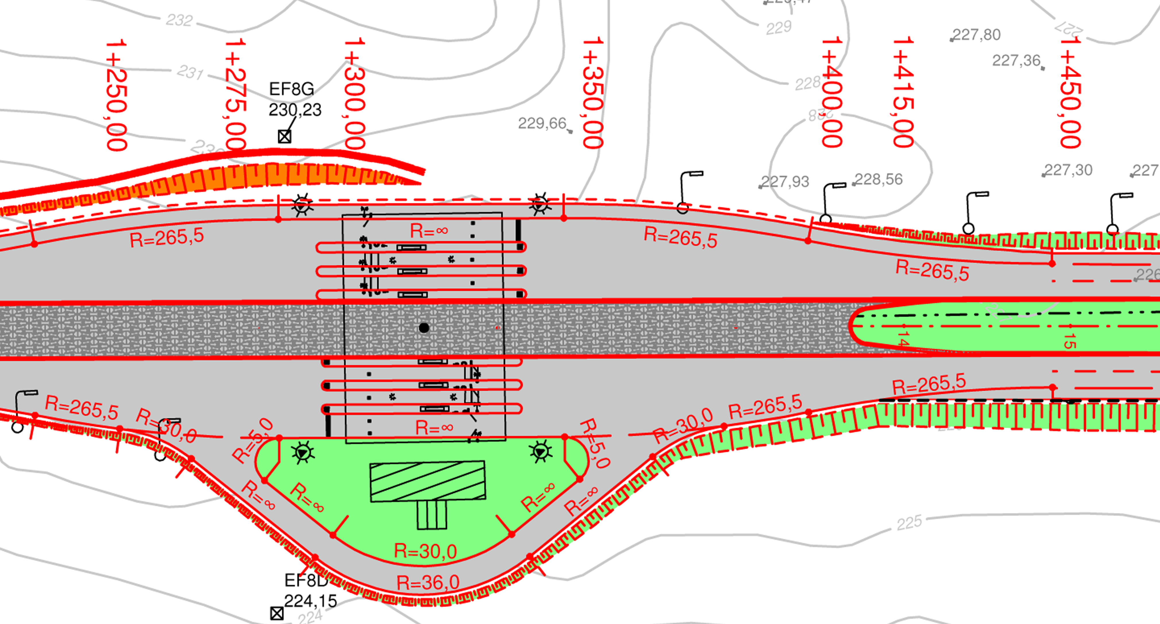
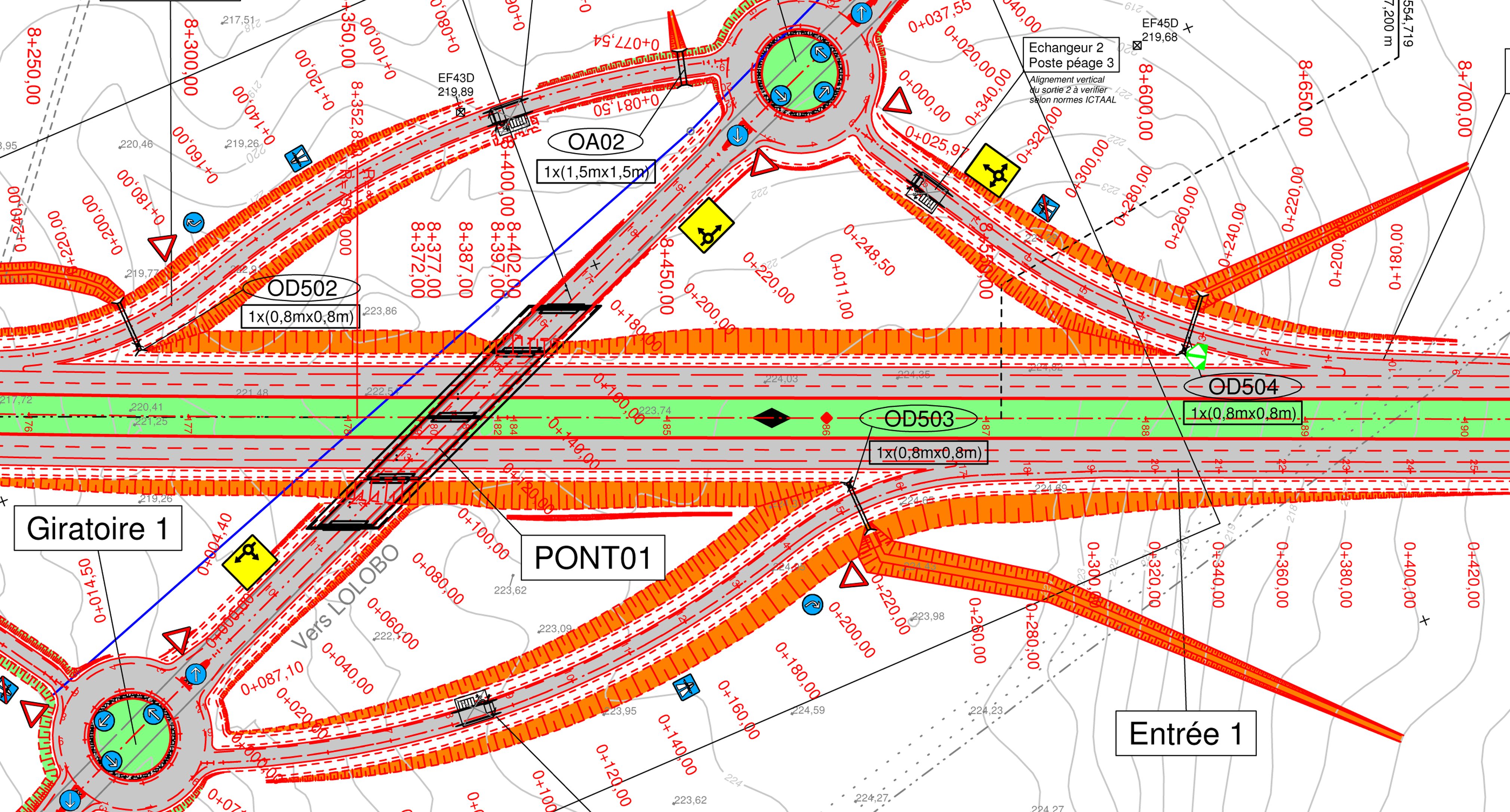
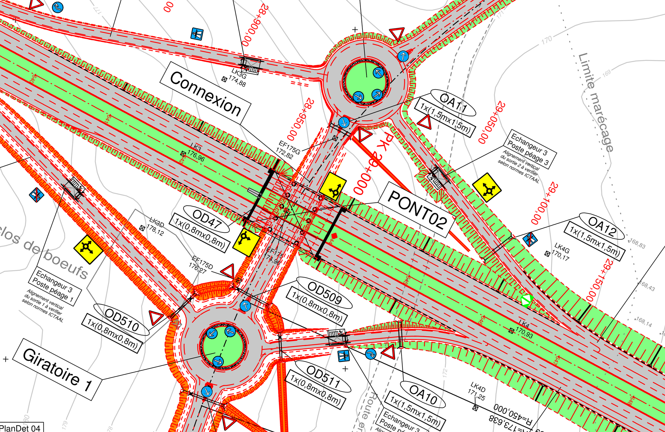
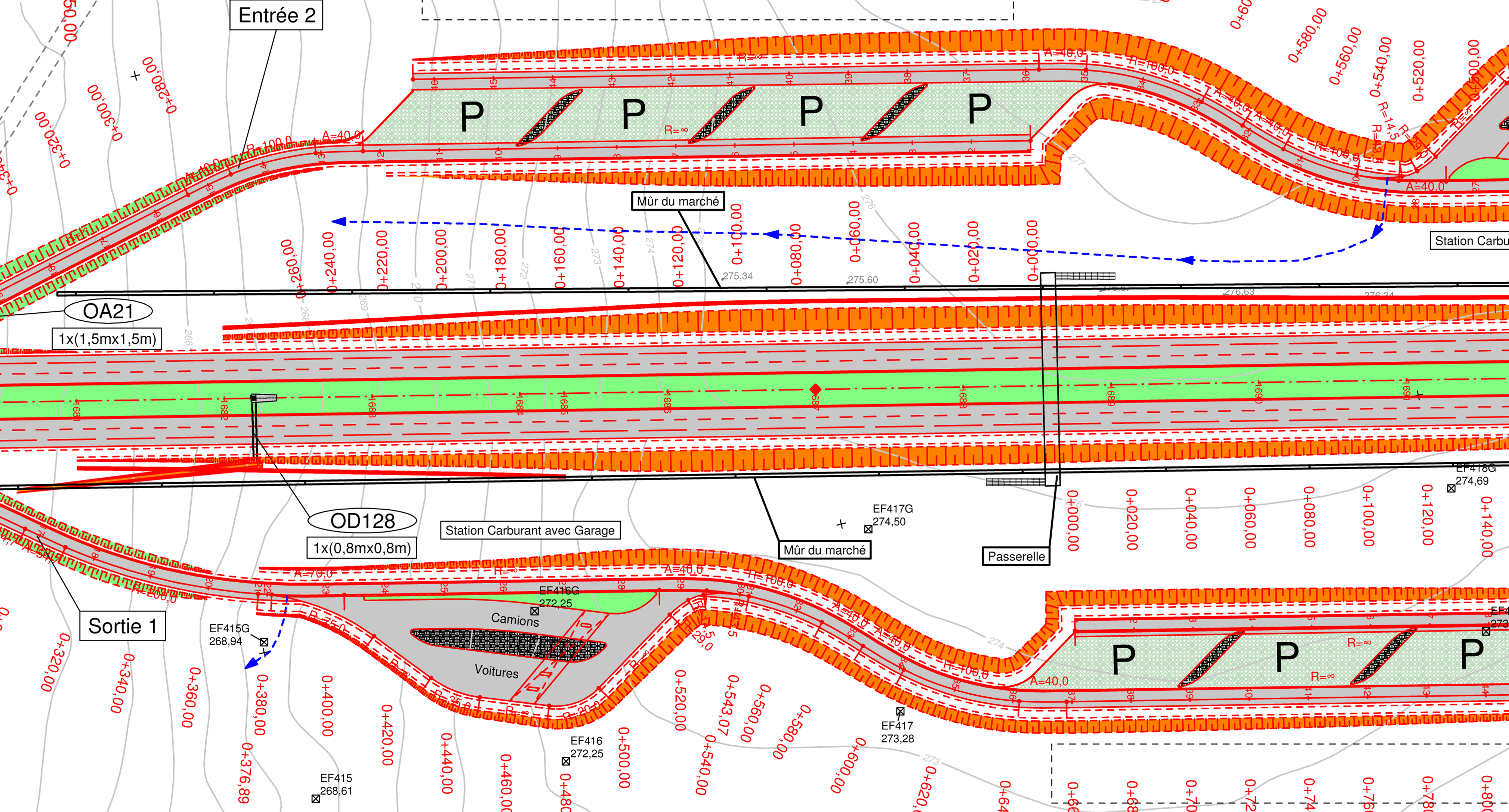
Gigantic Project Scope


Lot no.1 contained:
- 2 type 2 intersections (roundabouts)
- 5 parks (market places)
- 1 toll booth (2 large – 2 x 4 small booths at the entry/exits)
- 3 underpasses
- 5 pedestrian underpasses
- 2 overpasses
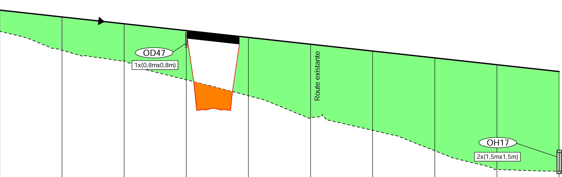
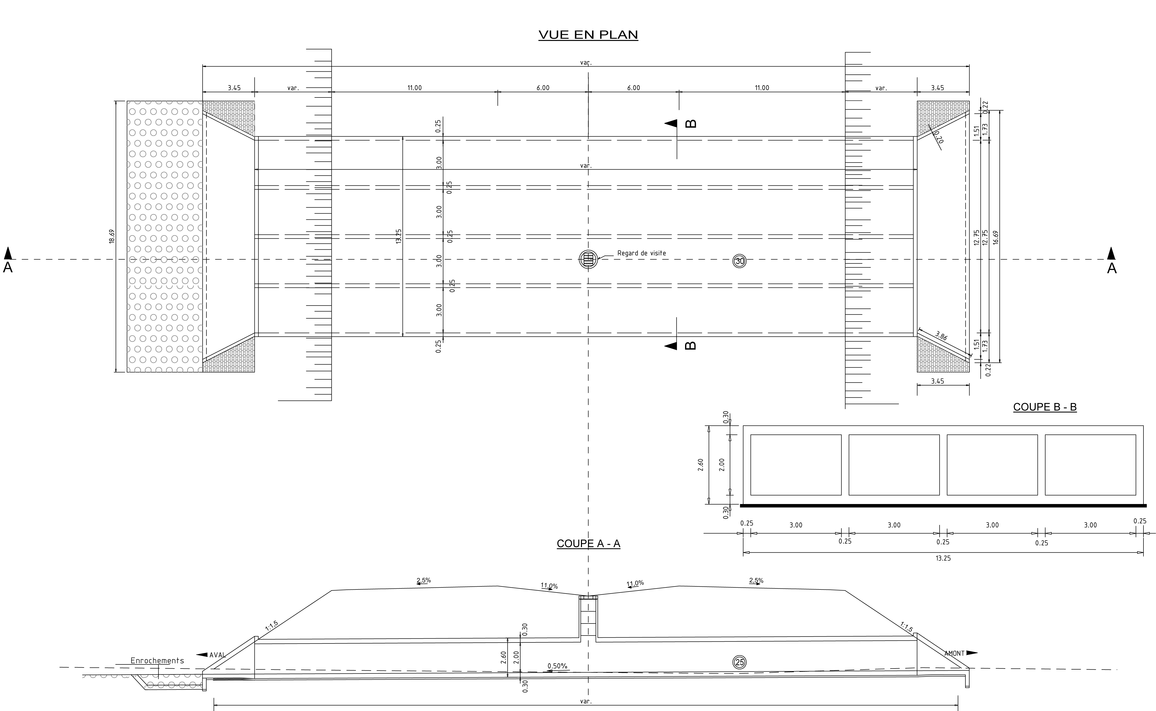
- 99 drainage structures
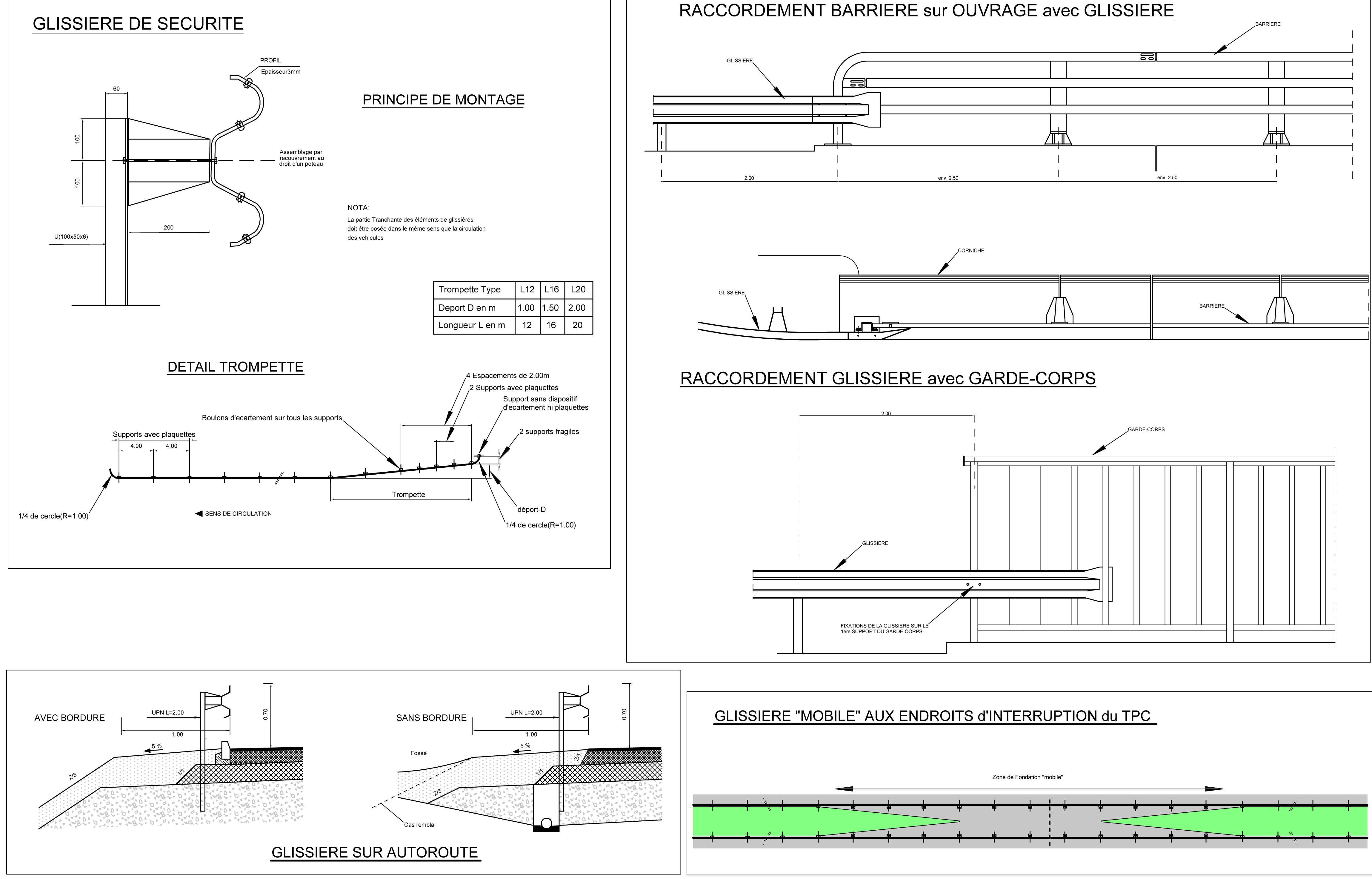
- 8 emergency bays on both sides
- 9 median strip crossings
- 5 pedestrian bridges over the motorway
- Signalling
- Safety measures
- Accompanying environmental measures
- Familiarisation measures for "local residents to get used to the motorway"
Lot no. 2 contained:
- 2 type 1 intersections (partial cloverleaf)
- 1 type 2 intersection (roundabout)
- 2 parks (market places), one with a petrol station
- 1 toll booth (3 x 4 small booths at the entry/exits)
- 8 underpasses
- 10 pedestrian underpasses
- 9 overpasses
- 1 bridge over the "KAN" dam: 100m.
- 250 drainage structures
- 37 emergency bays on both sides
- 30 median strip crossings
- 4 pedestrian bridges over the motorway / high-speed roadways
- Signalling
- Safety measures
- Accompanying environmental measures
- Familiarisation measures for "local residents to get used to the motorway"
Conclusion
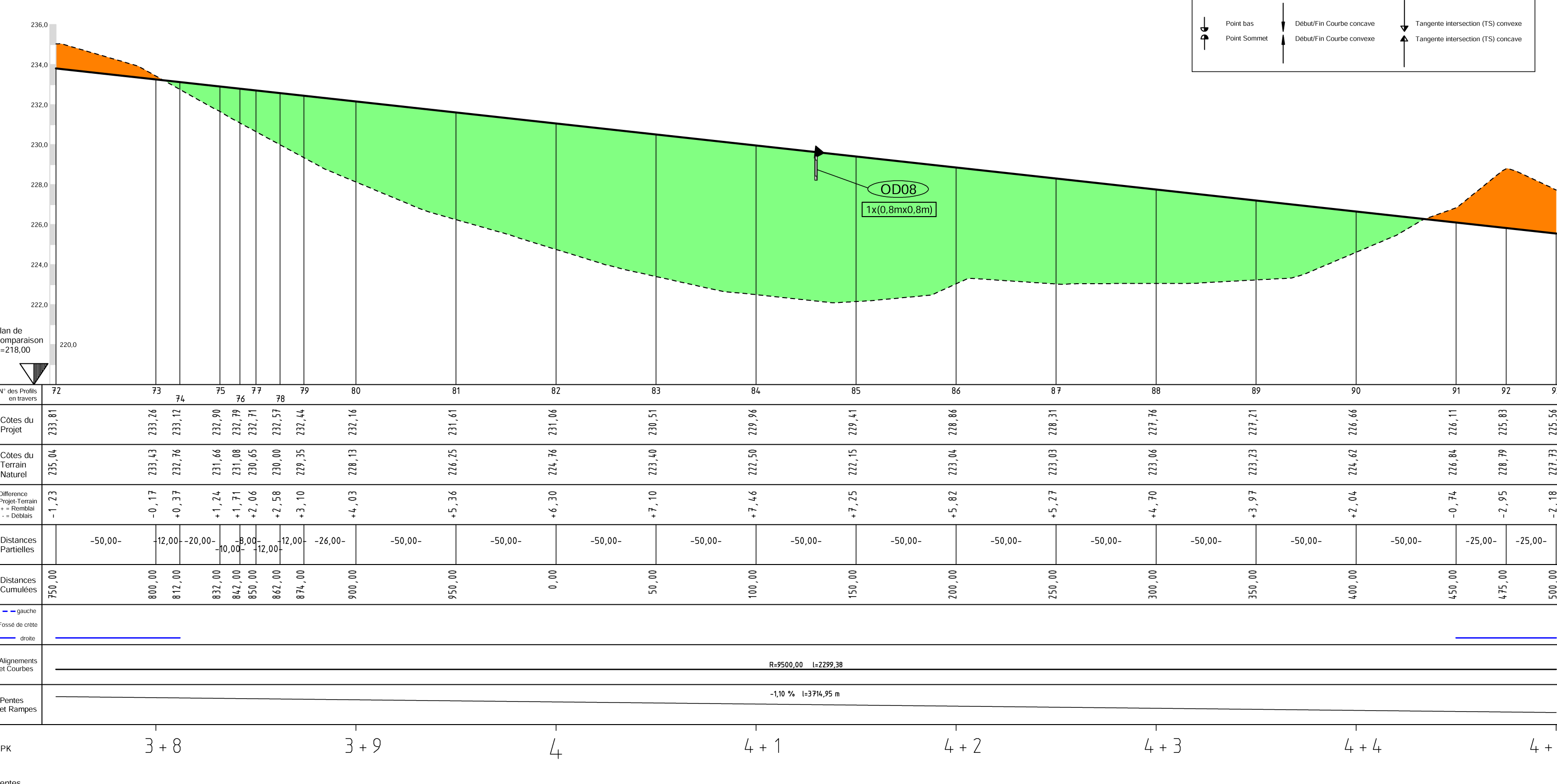
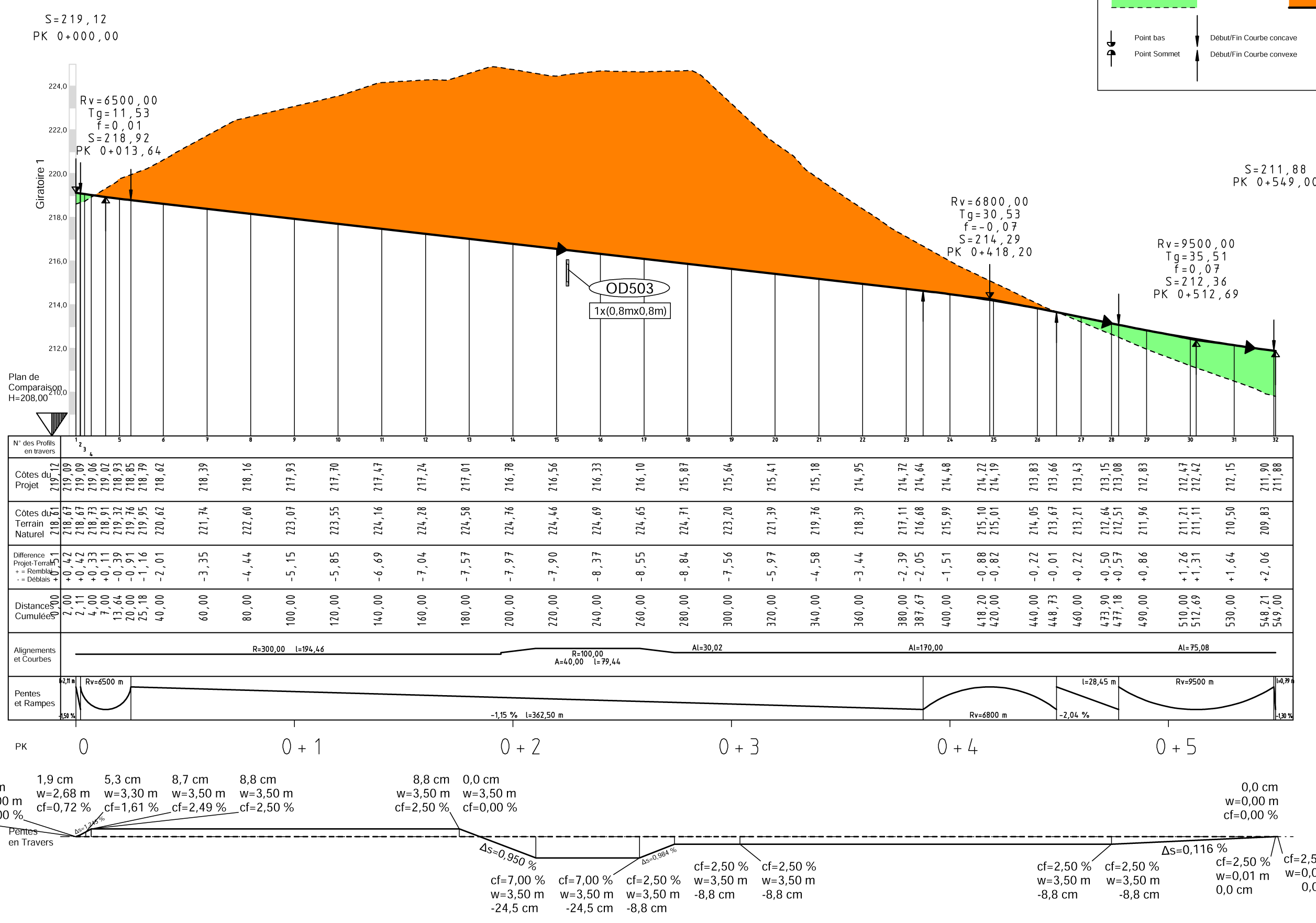
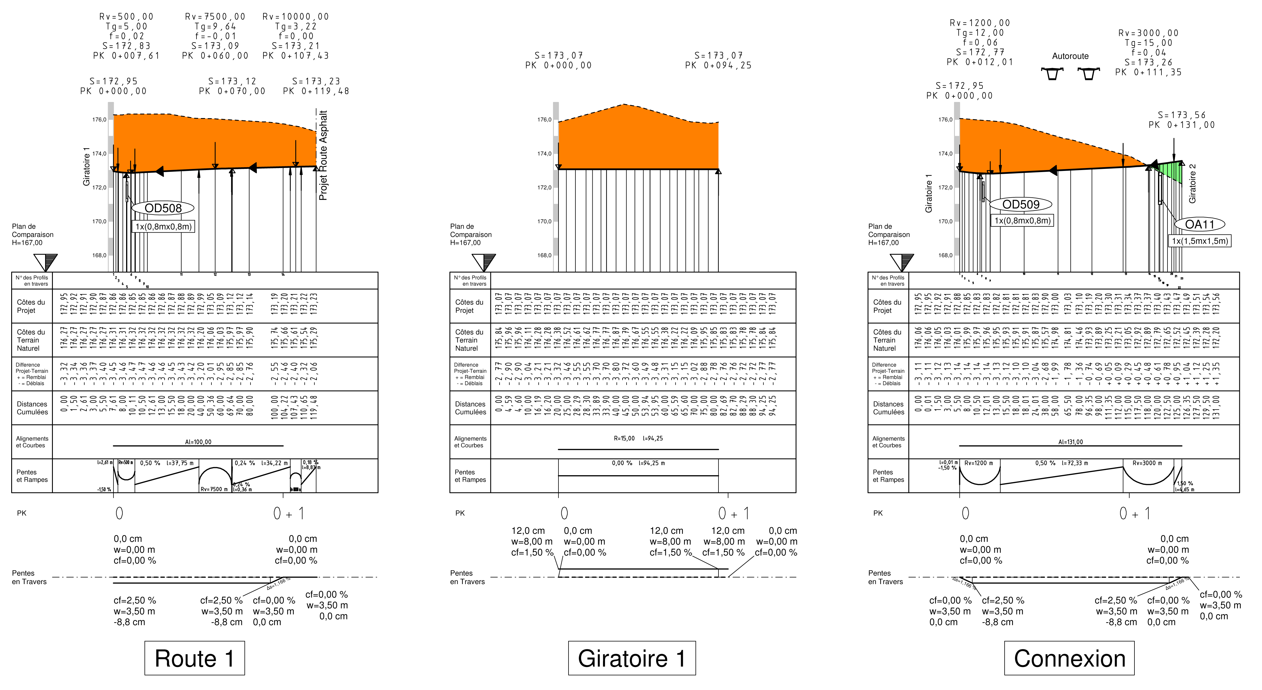
Despite the extremely tight deadline and the chaos of planning, the work was completed on time thanks to the surveying and design software card_1. Its flexibility was of particular value when adding and checking the numerous additional surveys necessary due to changes in design - right up to two weeks before the deadline. card_1's ability to generate the huge number of designs required also proved an enormous advantage. As was its ability to copy and move alignment groups when designing intersections and market places. These functions were vital to delivering the plans on time. The designs were submitted to the client as pdf or dwg files. The experts working for the local partner HydroCO, responsible for geology, hydraulics and construction, delivered the sketches, the planning was done with card_1.


Contractor:
Ingenieurbüro Benno Baumann
Peliserkerstr. 49
52068 Aachen
Fon +49 241 559355-91
E-Mail to Benno Baumann